
http://www.thehawkeye.com/story/Flint-River-precede-050312
http://www.thehawkeye.com/story/Flint-River-050512
http://www.thehawkeye.com/story/bike-fleche-051312
The Hawk Eye provided an image in the paper for everyone to see. The problem though is the fact that the resolution of the image is so crappy that its hard to tell where this trail is going to be ending up exactly, except for certain areas like Big Hallow and Starr's Cave Nature Center.
After looking at it, I decided to construct a full resolution of the map to show the details that are being left out.

There are a few problems that I see that is wrong with having this built.
Building it through private property and out-of-town:
For one, some areas of the track are going to be built on private property, meaning that the city has no authorization to touch such property since the owners bought it long before they decided to purchase pieces of their land to build a ridiculous bike trail.
What I don't understand is that The City of Burlington is building a bike trail that will stretch outside of the town's limits as well. What will give them the authorization to do that?
Flooding:
Another problem is the flooding from nearby bodies of water. Its not just the main part of the Mississippi that would flood out some of the trail occasionally, its also comes from the stream of water that intersects with Flint Creek that would also help flood the area out. That huge amount of area surrounding these bodies of water can and will flood out much of the bike trail.
Here's an image of the impact the 2008 flood had on the town. The image can be clicked on to see the full detail of the aerial map.
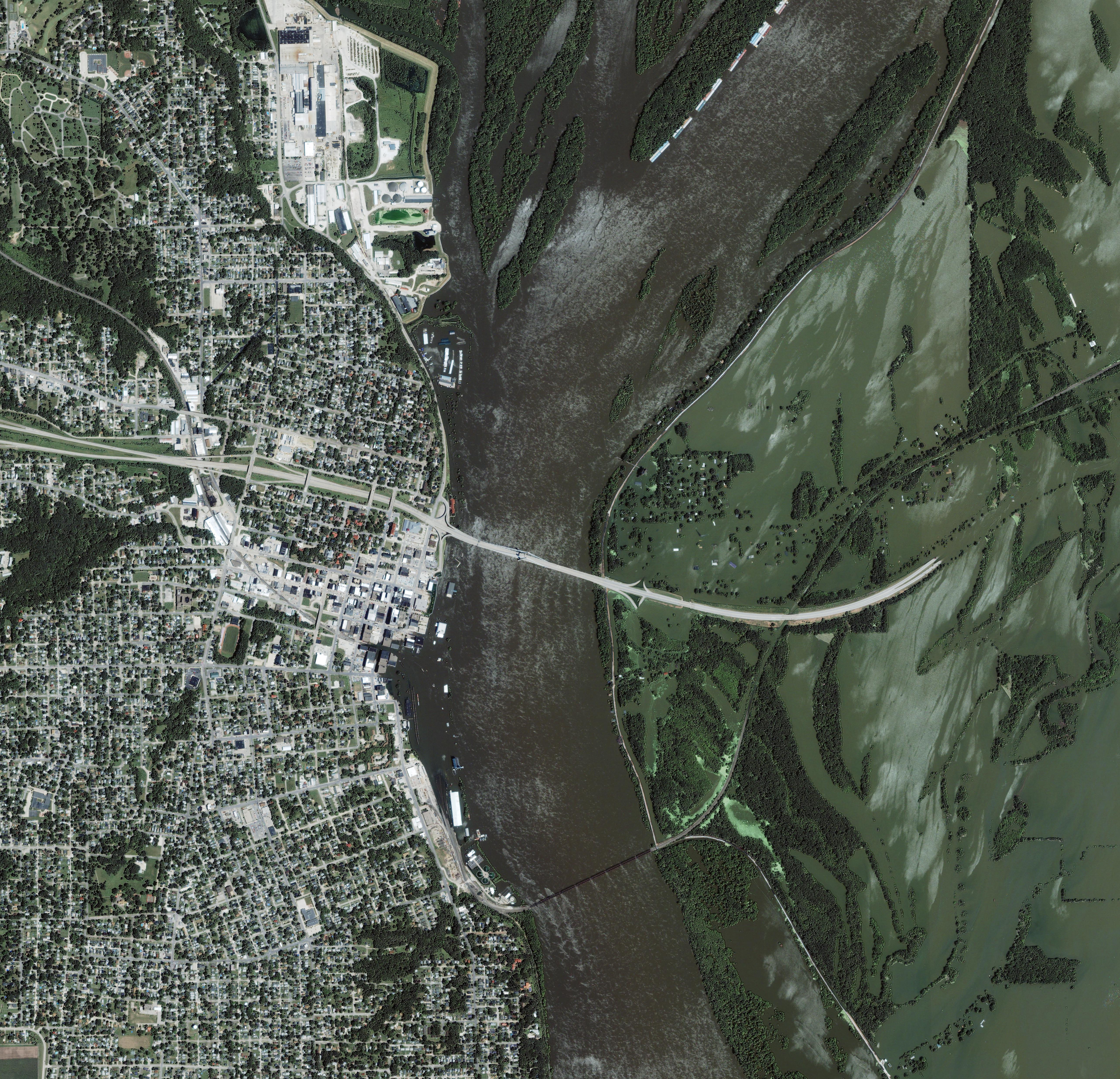
Even though the image doesn't show area's like around Mill Dam Road, the rest of Flint Creek, Starr's Cave Nature Center, those areas were also affected greatly. When I was around the area of Mill Dam Road, just away from Case Company, there are already some flooding coming from the river stream coming from nearby. This event happened a few days before the floods reached further to Case.
Years later, I tried researching for recent flood maps in the general area. All I found was a book that had flood maps of the town......from the 1980s. There was not a single piece of updated map material that was found in the library. There was no maps of the 1993 and 2008 floods; not even the smaller floods were reported in between those times, as well as afterwards.
Not too many people would be willing to ride their bike 20 miles back and forth:
This is also another problem that will arise after it is finished being built. How many athletic individuals in this town would be willing and able to pedal 20 miles onto the trail and 20 miles back?
What the newspaper articles didn't provide is whether the entire trip is going to be flat ground or hilly areas. Much of the city has plenty of hills and some areas that I looked into, like the beginning of the trail, does have some hills to them.
The big question is how many hills would be found on the bike trail that is being constructed and how steep are they?
No comments:
Post a Comment